Winnipeg
FTLComm - Winnipeg, Manitoba - Tuesday, February 8, 2011
My first visit to Winnipeg was to Christmas shopping and I must have been all of four years old. The wonder of the station lives on in my memory to this day. The marble, the massive washrooms and the Christmas displays. At that time and most Canadians travelled by train and the very reason for Winnipeg's existence was that throughout its known and archeological history Winnipeg has been a hub for travel. The first fur trading post was set up just nine miles north of the city centre of today to take advantage of the river travel of that era and when the railroad was built Winnipeg became the transportation centre of the northern portion of the continent.
Like Regina, Winnipeg looks like it is sitting on the flattest land that there can be. This is actually a huge optical illusion because both prairie cities sit in the midst of what once was a very large lake so that looking out from the cities' centres the horizon is much further away then the regular thirty-five mile curvature of the earth. Being in a flat lake bottom the horizon is actually a bit up hill and therefore much more than thirty-five miles.
I remember my first night approach to Winnipeg. Naturally I compared it to Regina or Saskatoon, cities with which I was familiar with while night flying. All cities and towns at night look much closer than they really are and all the lights seem to exaggerate distance when you peer down at them from 10,000 feet. On the ground it seems like the land used up by Winnipeg's 633,445 people is a huge place but that night looking down from a Cessna the place looked pretty small.
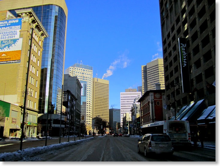
Winnipeg is relatively compact by comparison to cities like Calgary, Edmonton and Toronto each of which have substantial amounts of empty land that is part of the city. With Winnipeg you only see the island of forest that is Assiniboia Park, most of the rest of the land space is residential, commercial or office buildings.
The set of pictures that illustrates some of the things about Winnipeg were shot on three different days; on Thursday, January 20, in the late afternoon, approaching the city in a commercial airliner from the South. These images show the flood area on the South side of the city and the general lay out of the city. The second set of pictures were taken on the afternoon of Saturday, January 22 as we drive down Portage Avenue from the West and then just North of the central business core of the city. The third set of images were made this morning and were taken from the tenth floor of a downtown office building looking to the North and the West.