Winds Aloft
|
 |
| FTLComm - Tisdale - July 22, 1999 |
| |
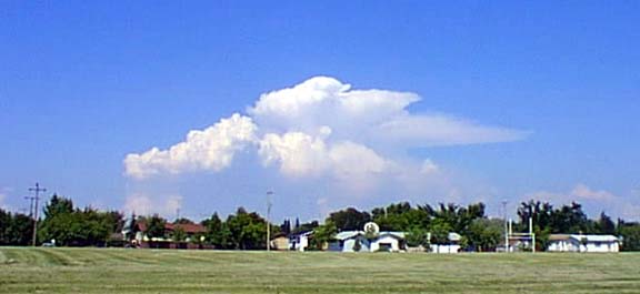
| We all know that the wind varies in speed from the surface upward and can even under
some circumstances be moving at a different direction. However, being told of this
and actually seeing evidence of the wind high above the surface is something we have
to look closely to see. This remarkable cloud seen Wednesday afternoon could have
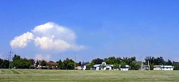
looked like it does below, were it not for the high winds in the upper atmosphere. |
 |
| The wind Wednesday afternoon was from the South West at about 12 knots and that is
fair breeze, enough to stop the aerial spray planes from working. The picture above
is merely a little fiddling with the actual scene at the top but a normal towering
cumulus or Nimbo-stratus cloud like this is essentiall a large muchroom cloud. Hot
air rises in a column upward and carries with it water vapour but that air is chilled
as it moves up and the condensing water vapour forms the cloud. The very cold air
is a sort of top on the development and the warmer air now heavier and chilling tumbles
out and downward forming the characteristic shape of the cloud. |
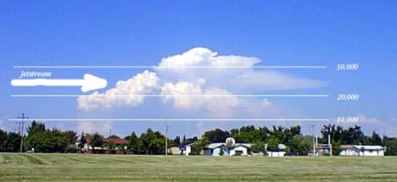 |
In this diagram we can visualise the action of the jetstream. Remember the surface
wind is from the South but the Jetstream is clearly seen in this image coming from
the North West (This picture was taken looking North). You can see the affect of
the wind as it knocks the rising column of air off to the East even though it continues
to rise with its upper section grossly distorting and ice crystals (the fine spread
out end to the right) being pushed well away from the main portion of the cloud.
The numbers on the right indicate approximate elevations in feet from sea level and
from the look of the extent of movement the Jet stream could easily be between 70
and 120 knots as it is passing into and well above this cloud formation. |