SuperClouds
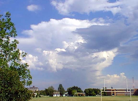

Yesterday we experienced some of the warmest temperatures of the summer and mid afternoon this is what happened. Saturday was interrupted by the incredible rapid development of these clouds.
Clouds of this type which can reach up to and above thirty-thousand feet usually require up three hours to develop to maturity and then they become unstable and drop the rain that they have been making from the rising water vapour. However, the high temperatures were producing clouds of this type in less then an hour and one could witness their development in minutes. This inordinately rapid pace of development is a feature of the tropical zone but is not often seen this far North.
We had quite a heavy shower shortly after these pictures were taken and the clouds and their related storms moved through the area throughout the early evening until around 9:30 when the temperatures were low enough to see the rapid developments subside.
Clouds of this type develop and end their life to quickly to produce hail or the associated funnel clouds that are referred to as tornadoes when they swing toward the surface. However, conditions were unusual with low to nonexistent winds and high humidity. The missing elements that create the really nasty stuff took the day off.