 |
|
Over The Yukon And Cassiar |
| FTLComm - Watson Lake Yukon, Tuesday, November 27, 2001 |
 Today its time for a little adventure over one of the most exotic and perhaps lease known parts of Canada. The pictures on the page are shown in sequence and illustrate the way things look over this mix of alpine and boreal forest region of Northern British Columbia and South Eastern Yukon. During the time we lived in the Yukon flights like this one were routine and my log book shows two such flights in the fall of 81 and 82 and there is no way to distinguish which one is seen here. |
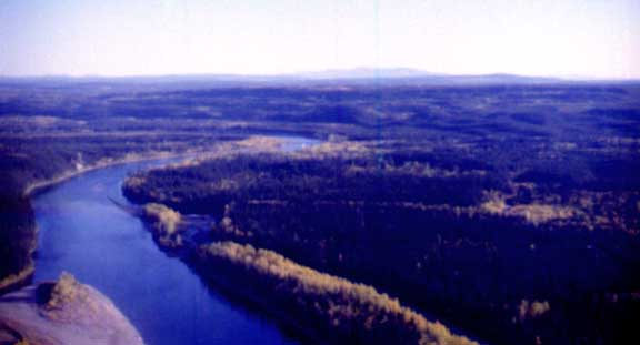 |
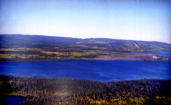
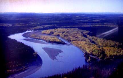
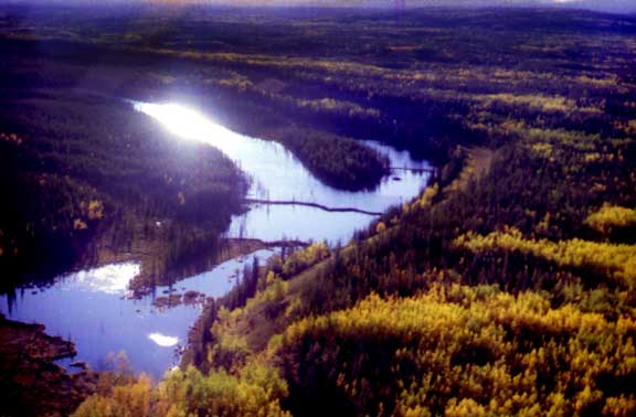
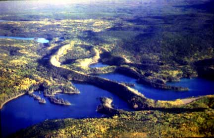
 The picture at the top of the page shows Watson Lake's airport looking back on it from the South West and you can see beyond the airport the ski hill. The next to pictures show the Liard River up river from the canyon and the one above shows the turn at the BC village of Lower Post. Stretching out to the South is the Tintina Trench, a wide rift valley that stretches from Montana to Dawson City in a remarkably straight line. |
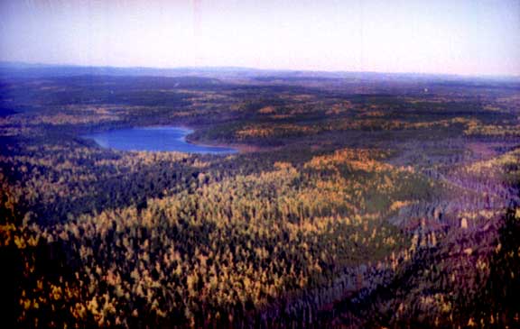 |
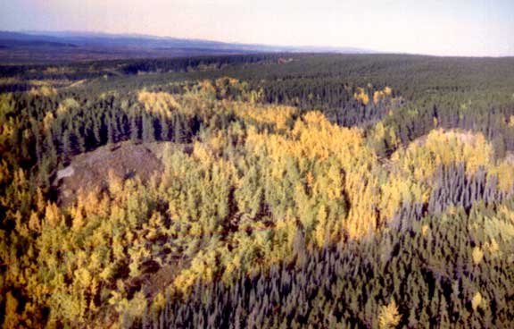
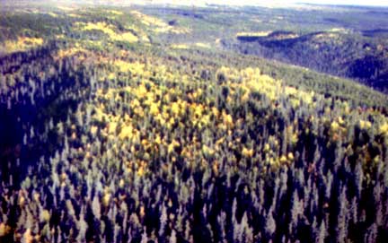 Be these in 81 or 82 does matter since both trips were in the first week of September and as you can see the forest here is mixed with a lot of trees turning colour. Because of the very short but intense growing season these trees are about seventy-five feet tall and are extremely fine grained. Each growing season lays down only a small amount of tree and logs from forest like this have growth lines that are amazingly close together. |
 |
 |
 The scene above is a small stream that flows into the Dease River and here we can see the complex and extensive work of Canada's national animal. Beaver damn after damn control the flow in this stream. This picture shows a great example of an esker. A river flowing through or on a glacier develops a gravel bed and when the ice recedes the river bed remains like a highway built above the surrounding land. |
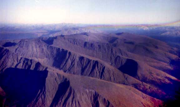 |
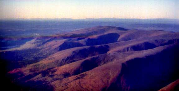
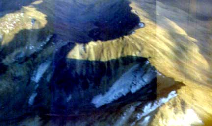
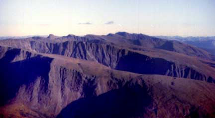 The wide plain at the bottom of the Tintina trench has many areas where glacial remains form the surface. On the West side of the trench are the Cassiar mountains which we are peaking over (above) with the Horseranch formation situated in the trench. The Cassiars are about 6,200 feet and though rugged they |
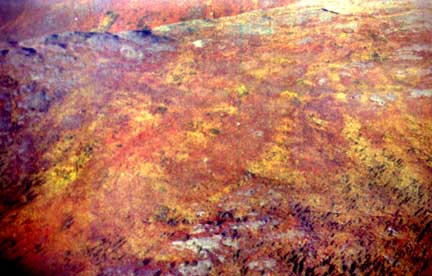 are not the kind of jagged peaks seen in the Tungsten range three hundred miles North. But even these apparently barren mountain tops are covered with life best seen in the fall when the shrubs and lichen turn colour producing this magnificent show. We are seeing this mountain top from about five hundred feet. The contrast is quite remarkable as you can see in this image the Cassiars but the picture below is of the |
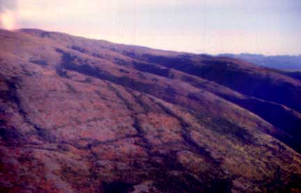 scraped off (by glaciation) Horseranch formation which also has growth upon its sides and top but is smoothed over. The Horseranch seen below is an anomaly situated in the Tintina rift valley trench itself well separated from the Cassiar range twenty miles to the West. The floor of the Trench is usually about 3500 feet as is the McDame Creek valley in which the town site of Cassiar was constructed. |
 |
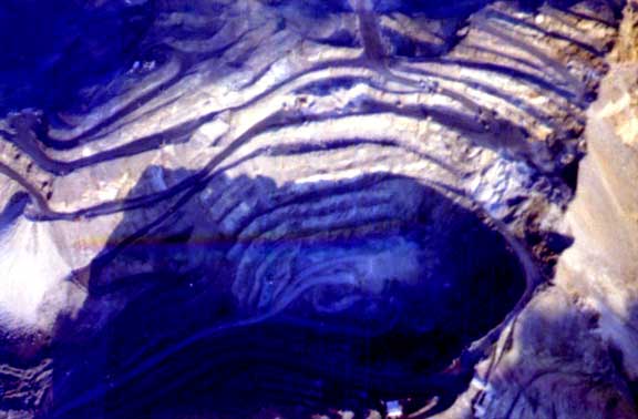
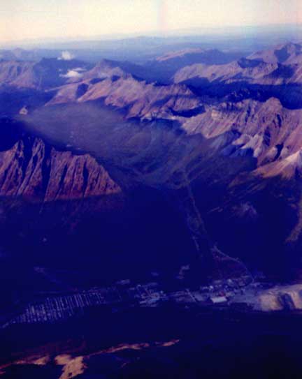 The picture is looking almost due North across McDame Creek over the town site of Cassiar and up the valley toward the asbestos open pit mine. The deep shadows from the setting sun fill the valley and bring premature darkness to the town site. The mountains that surround the town gave it a short day and as a visitor from the prairies it was a very uncomfortable place to be. In the winter it seemed like it was always in darkness and because of the closeness of the Pacific ocean Cassiar often received as much as thirty-five feet of snowfall each winter. You can see two lines reaching North toward the mine. One of these is a road the other is a tram line elevated above the terrain and used to bring the ore down to the mill in the town. The asbestos was removed from the ore and the unused material dumped into the "tailings pile" seen on the right in this picture and perhaps clearer in the picture below. The Cassiar asbestos was not like the powdery stuff we think of that comes from |
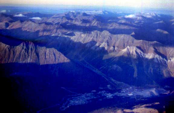 |
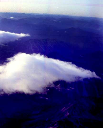 Quebec's Tetford mine. Cassiar's produce consisted of glass like fibres from two to six inches long. The fibres were an aqua to green colour and found with it in the ore body were huge amounts of jade. There were boulders of jade the size of a house found in the mine but since jade is a crystal the mining process of blasting damaged much of the material making it useless and unmarketable. However that tailing pile was off limits and a secure area. Now with the mine having been closed for more than fifteen years the only mining right in Cassiar that still goes on is in that tailings pile. Only a few miles East of Cassiar in the McDame Creek, up on the mountainside is the source for most of the gold mined in Canada at this time. This little cloud can be see in the pictures above as we dropped from close to twelve thousand feet for the pictures of the town site to around seven as we pass over the mine site below. With digging equipment and trucks seen in various parts of the picture. |
 |
 Just behind the mine there was believed to be a similar massive asbestos ore body but the economics of asbestos shut this project down. The fibres from conventional asbestos mines were used in construction, vehicle parts and because of their permanent nature and indestructibility they were deadly to humans with the fibres lodging in lungs and cancer resulting. The Cassiar product was not like that when it came out of the mine as the fibres were very large. However, the uses of the product did resort to breaking those fibres up into small pieces and the whole industry of extracting asbestos was doomed. |