|
|
||||||
|
Spring run-off |
||||||
| FTLComm - Tisdale - Tuesday, April 6, 2004 | ||||||
 There is no way to know if this is real or just a moderation of the past years of drought. There was no run-off in 2002 or 2003 so the movement of water this year is giving folks some hope that just perhaps we have made it around the dry spell and can expect closer to normal moisture levels for this part of Saskatchewan. The temperature got right up there today with the sun getting us up into the teens but on Saturday when this first set of pictures were taken we had the sunlight but the temperature was hovering around +5ºC at 11:00 when I drove out of Lindenbach's yard (right) to see how the Shand was making out. |
||||||
 |
||||||
|
|
||||||
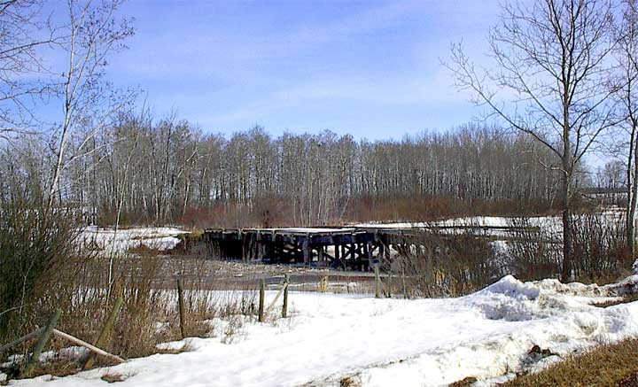
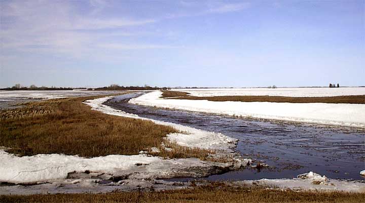
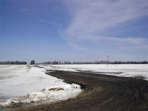
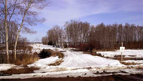 As you can see this East looking picture (above) shows the fields are pretty well covered Saturday morning. The picture at the top of the page and this one (right) show the Shand as it hustles across the very flat countryside four miles east and six miles north of Weekes, just south of the Doncrest cemetery. Though there was some ice trash in the stream it was flowing nicely well below flood level and working its way under the very old bridge. |
||||||
 |
||||||
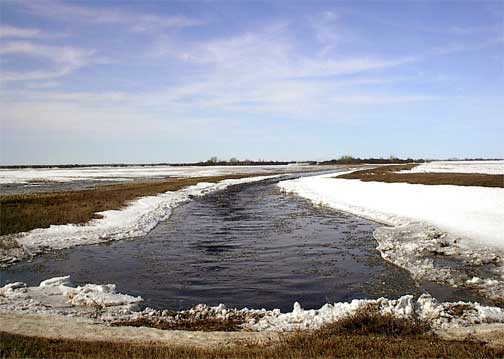 This is the Shand just south of the Wilsonholme farm as we look west (above) and east (right) atop the culverts on the grid road. Because the country is so flat in this area, most years the gently boundaries on each side of the Shand are unable to confine it to the channel and it sort of spreads out. Wilsonholme's actually have a dike that surrounds their farmyard. Below is another stream that feeds into the Shand just east of the Wilsonholme farm site and though it is flowing nicely there is still a lot of snow to liquefy and run into the stream. |
||||||
 |
||||||
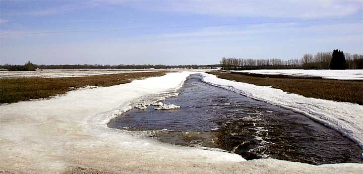
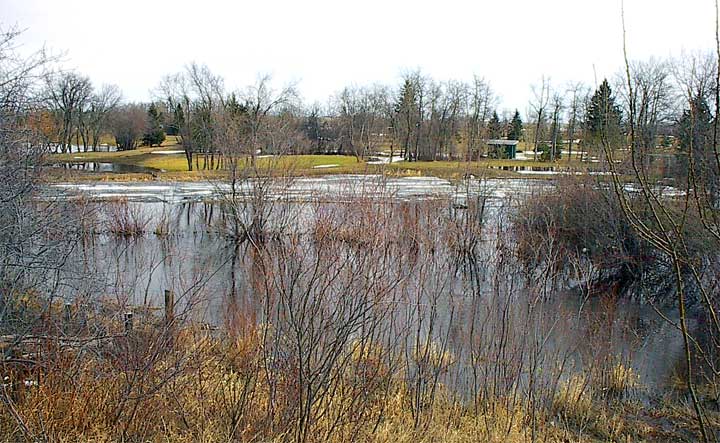
 The road allowance is east of the grid road and since no one lives up this road it is not accessible with snow still covering it and the bare spots pretty muddy. This is a road not taken. (My wife says this shows that I am maturing as in the past such a road was always a challenge for me and always resulted in the adventure of getting stuck.) Several miles south (below) beside Arnold Denham's farm yard the Shand is much fuller though within its banks on the north side, it is flooding on the south side. From the picture above to the one below the water would have traveled perhaps as much as twelve miles as it winds its way across the flat countryside. |
||||||
 |
||||||
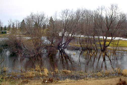
 The tree line in this picture (right) is the farm yard (above) and as you can see this field and those west and south of it are almost all underway. This brief submersion poses no threat to the land as it will soak up some of the water and fill up the water table. The top soil is fairly thin in the area with many of the fields actually not soil at all but peat moss. Huge crops can be produced on fields in this area and most of the farms in this area have substantial cattle herds. Only a few miles east the land is less valuable and used mostly for pasture while only four miles south it is solid forest. |
||||||
|
|
||||||
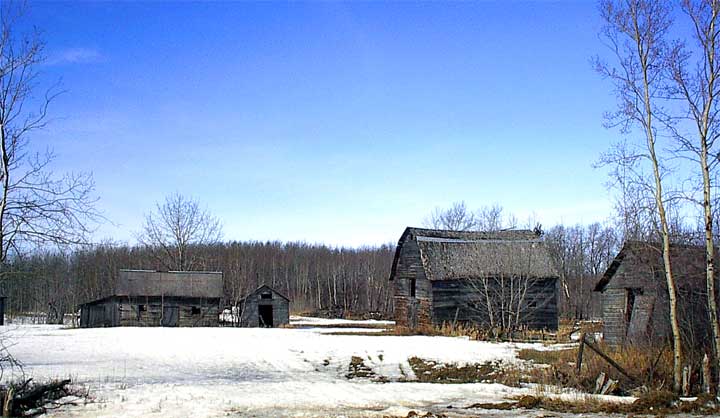
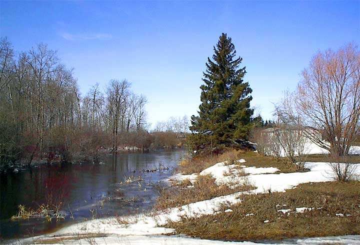
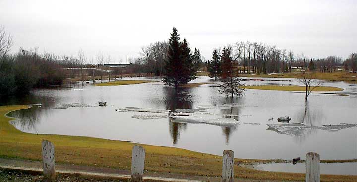
 This is one of the many old farms that has long since been absorbed by larger farm operations in the area but as you can see on Saturday it still looked pretty much like winter. We now fast forward three days and 45 minutes west to Tisdale's Riverside golf course where the Doghide has widened out on to the greens and fairways of much of the course. This would be fairly normal for most years as the snow goes the very small channel of the river simply can not handle the once a year flow and it spreads out. |
||||||
 |
||||||
 Reports from the Southwest corner of the province from the Orkney area near the Montana border are that there was no run off whatever but the ground water is up and the dugouts are looking pretty good. In the Kelliher area and all along both sides of the Qu'Appelle valley there was more snow than in this part of the province and though the fields there are now mostly free of snow the yards are still white and very wet. It is interesting to remember that this water has to work its way north to the Carrot River then on to the Saskatchewan system and eventually end up flowing into |
||||||
 |
||||||
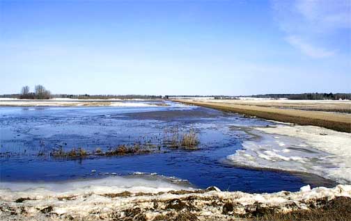
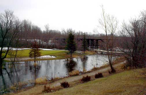
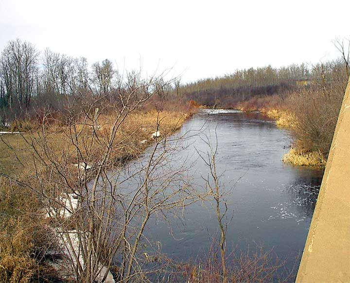
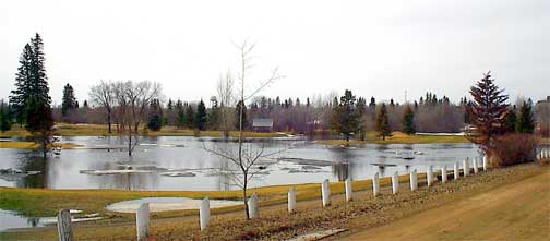 the Hudson Bay. The picture above and on the right show the northeast corner of the Riverside golf course almost entirely submerged. The Doghide was actually supposed to have been higher yesterday at the old bridge north of town (below) but it is moving right along with a cheery rapids burbling away only a hundred yards away. |
||||||
 |
||||||
 It is truly a time to get a picture of the run-off because of the hope and inspiration that comes from the movement of water across a land that has been almost in dust bowl conditions for many years. We have frost in the ground which prevents absorption of the water a few feet down but the upper portion of the soil is soaking up all it can get and will have just the right amount to get the crop of 2004 off to a nice start while allowing farmers to get out on the fields soon. |
||||||
|
|